Home → Water Quality → Monitoring → Rivers and Streams → Volunteer River Monitoring Program
Volunteer River Monitoring 
Program (VRMP)
Introduction
|
Introduction
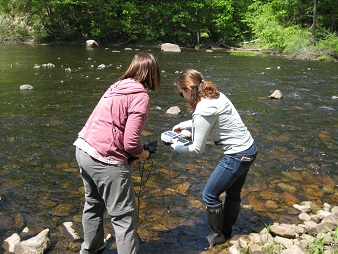
In 2009, the DEP launched a statewide volunteer river monitoring program (VRMP). The VRMP is a network of volunteer groups participating in quality-assured river and stream sampling. The program operates under a program-level Quality Assurance Program Plan (QAPP). Individual volunteer groups develop Sampling and Analysis plans to tailor the program-level QAPP to their specific project goals. As part of the program, VRMP staff provide annual trainings and certification, guidance about data quality objectives, technical support and assistance, data storage in DEP's Environmental and Geographic Analysis Database (EGAD), and annual reports.
History
DEP began work to establish a statewide volunteer monitoring program in 2004 because of the lack of standardization among volunteer monitoring groups and centralized access to data. In addition, a 2007 report assessed the need for a statewide citizen-based monitoring program and demonstrated the benefits of such an initiative. If you would like a copy of this report, "Citizen Stewardship and Monitoring for Clean Water in Maine", please contact program staff.
Program Contact
Kristin Feindel (Program Coordinator) - (207) 215-3461
Volunteer River Monitoring Program
Maine DEP
17 State House Station
Augusta, ME 04333-0017
VRMP Data
- VRMP Data Dashboard – Recent data collected by VRMP groups. Map of sites, graphs of results and data by site. Can filter by year, organization, and other attributes.
- VRMP Annual Data Reports – Summary of program information, parameters collected, sampling locations and results for each organization by sample year, beginning in 2013.
VRMP Monitoring Guidance Documents
- VRMP Quality Assurance Project Plan (QAPP) (PDF)
- VRMP QAPP Appendices (PDF)
- VRMP QAPP Standard Operating Procedures (SOPs) (PDF)
- Stream Survey Manual
Current Volunteer GroupsContact your local volunteer group to get involved. Field sampling is generally June-September. |
Androscoggin River Watershed Council:
Upper Androscoggin and Tributaries
Contact: Becky Secrest
(207) 318-4217
Friends of Merrymeeting Bay
Lower Androscoggin River, Lower Kennebec River, Merrymeeting Bay
Contact: Ed Friedman
Friends of Scarborough Marsh
Scarborough Marsh Tributaries
Contact: Greg Bither
Hallowell Conservation Commission
Vaughn Brook
Contact: Rosemary Presnar
Mousam and Kennebunk Rivers Alliance
Kennebunk and Mousam Rivers and Tributaries
Contact: Betsy Smith
Presumpscot Regional Land Trust
Presumpscot River and Tributaries, Stroudwater River
Contact: Toby Jacobs
Rockport Conservation Commission
Rockport Harbor and Tributaries
Contact: Bob Kennedy
Skowhegan Conservation Commission
Currier Brook and Whitten Brook
Contact: Kate Drummond
Weskeag River Monitoring Project
Weskeag River and Tributaries
Contact: Theo Pratt
Other Data
- Maine Department of Environmental Protection
Maps and Data Page - A wide array of data types available from MDEP.
Rivers & Streams - Biomonitoring Maps and Data
- Gulf of Maine and its watershed
Knowledge Base. (off-site) Catalog of datasets and documents for the Gulf of Maine.
- U. S. Geological Survey (Maine region)
U.S. Geological Survey (Maine region) - The Maine water science center-including flow data.
- Wells National Estuarine Research Reserve
Seacoast Watershed Information Manager - Provides tools and information to guide sustainable management of your community's water resources.
Links
Training & Education
- Stream Corridor Restoration Handbook (USDA)
- Volunteer Stream Monitoring: A Methods Manual (US EPA)
- Watershed Academy: Online Training in Watershed Management (US EPA)
- The Buffer Handbook
- Nonpoint Source Training and Resource Center (Maine DEP)
State/Regional Resources
- Streams - from the Gulf of Maine Research Institute
- Maine Rivers
- Maine Department of Inland Fisheries and Wildlife
- Downeast Salmon Federation
- Project SHARE - Salmon Habitat And River Enhancement
- Maine Environmental Policy Institute
- New England Interstate Water Pollution Control Commission
- Maine Department of Marine Resources
National Resources
- US EPA- Office of Water
- River Network
- Adopt-A-Stream Foundation
- Izaak Walton League: Save Our Streams Program
Other Useful Links