DACF Home → Bureaus & Programs → Maine Geological Survey → Explore Maine Geology → Coastal Marine Geology → Saco Bay Beach Morphology → Results → Figure 22
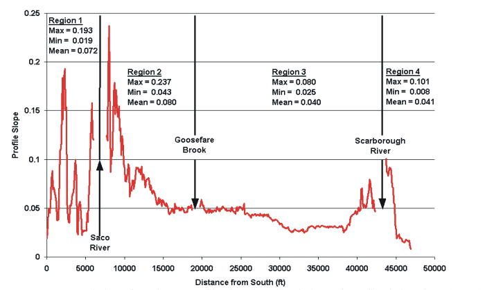
Figure 22. Variation of beach profile slopes. Steepest slopes are adjacent to the Saco River, and generally decrease from south to north. Steep slopes within the northern part of the bay are nearest the Scarborough River and along Western Beach. Slopes derived from 2000 LIDAR topographic data.
Last updated on January 9, 2006.