DACF Home → Bureaus & Programs → Maine Geological Survey → Maps, Publications and Online Data → Using Geologic Maps → Reconnaissance Surficial Geology Maps
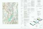
Surficial Geology 1:62,500-scale Maps Description
What are surficial deposits?
Sand, gravel, clay, and other unconsolidated materials that overlie bedrock are known as surficial deposits. They cover most of Maine's land surface and include sediments deposited by water, wind, and glacial ice. Glacial deposits are by far the most abundant surficial materials in Maine.
Reconnaissance Surficial Geology Maps
Surficial geologic maps differ significantly from soils maps because they identify the deeper earth materials that lie between the soil zone and the underlying bedrock (soils commonly develop by weathering of the uppermost part of these materials). In addition to the distribution of unconsolidated surficial deposits, the maps also show glacial landforms, directions of glacial ice movement, and other specific features. The map explanation describes the composition of each deposit, its characteristic topography, and its origin.
Surficial geologic maps are compiled from field work, well and test hole data, and aerial photograph interpretation. In the field, the geologist examines as many exposures of surficial materials as time and access allow, recording information on the type, thickness, texture, and structure of the sediments exposed. Reconnaissance-level surficial maps are prepared by examining gravel pits and other readily accessible exposures of surficial earth materials, and gathering information on remote areas through the interpretation of aerial photographs. Detailed-level mapping involves more comprehensive field work, together with compilation of data from wells, test borings, seismic surveys, and other sources. Well and test hole information is important in determining the thickness of surficial deposits and mapping the extent of older deposits covered by younger materials.
Uses of surficial geology information
Identification of surficial materials is critical for making a number of land use decisions, including determining the suitability of an area for development, planning major construction projects, or looking for sources of ground water. Surficial geologic maps also provide information on the location and extent of sand and gravel deposits. Large scale (1:24,000 or larger) maps are most useful for investigations of particular sites.
How to obtain or view these maps
Use the Maps and Publications Search to identify printed and online publications available from the Maine Geological Survey. You can search for maps and publications by geographic area or subject. Search results are linked to online publications. To order printed materials see the ordering instructions.
Use our online surficial geology map list to link directly to the quadrangle of your choice.
Last updated on July 15, 2015